Trip to Sognefjorden
Part one - From Vċgo to Beitostölen
As usual I used Otta as the base for my trip in June 2007. Last fall I had been on the trip over from Ċndalsnes by Geiranger to Stryn and had a stop at town of Lom located at the foot of a giant mountain that serves as a guardian to the high mountains of Jotumheim, the home of the giants.
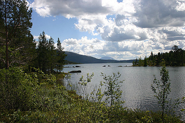
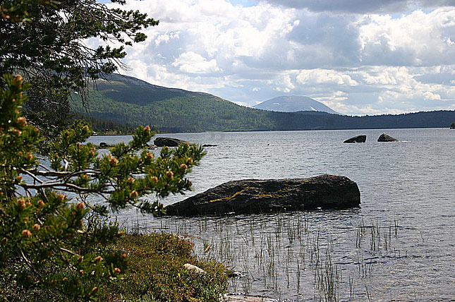
The fjord reaches a maximum depth of 1,308 m below sea level. The greatest depths are found some way inland: near its mouth, the bottom rises abruptly to a sill about 100m below sea level. The average width of the main branch of the Sognefjord is about three miles. Cliffs surrounding the fjord rise almost sheer from the water to heights of 1000m and more.
NĉrĝyfjordBoats connect settlements along the fjord and its sidearms. Towns on the fjord and its branches include Balestrand, Gudvangen and Flċm. Gudvangen is situated on Nĉrĝyfjord, a branch of the Sognefjord particularly noted for its unspoilt nature and dramatic scenery ([1]), and only 300 m across at its narrowest point. From Flċm, the famous Flċmsbana railway climbs 864m up to Myrdal in only 20km - the steepest unassisted railway climb in the world.

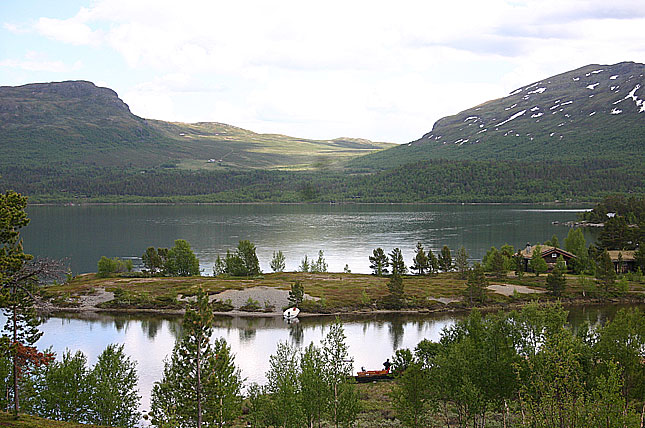


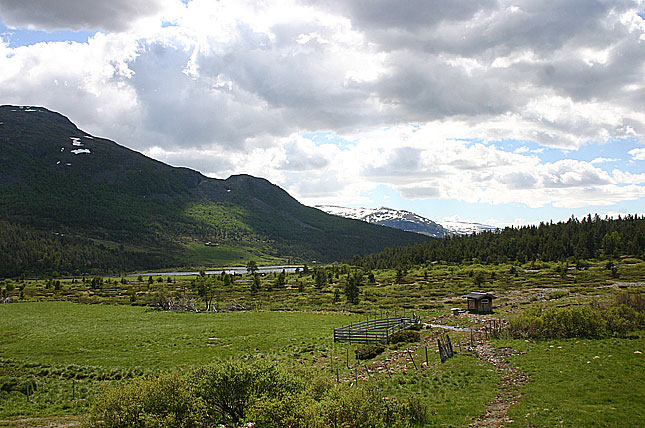
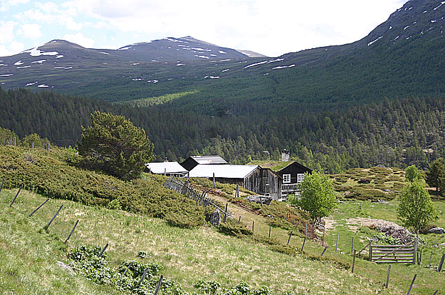
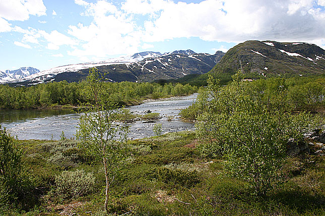
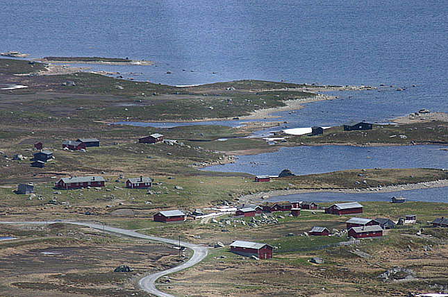
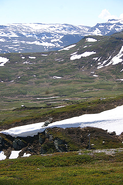
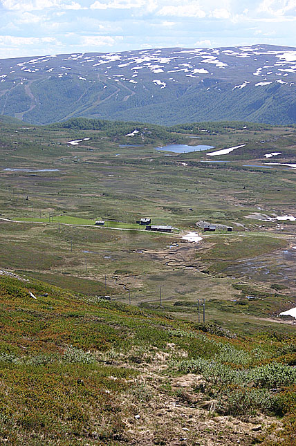
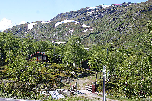
I have since fall of 2006 planned on a trip from Vċgo to Sognefjord. The highway 51 starts some 10 kilometres west of Vċgo and soon climbs up to a mountain pasture. Here the white capped mountains are surrounded by lakes and there are a plenty of weekend cottages, camping sites and ski resorts. But after a while, after passing Randsverk the landscape allmost unnoticeble drasticly changes to a very picturesque alps.
At a tiny hamlet/resort of Bessheim we soon reach the summit over 1300 meters over the sea level. At this point the road climps over a mountain ridge, like the road is heading to the sky.
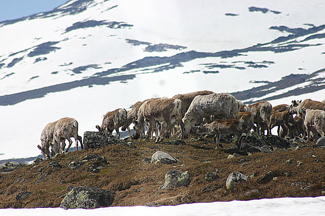
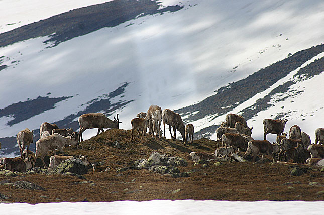
Here I had a strange and unexpected crossing as some fifty reindeers crossed my path. This did cause some exitement among the tourists as all the traffic stopped and people pickd up their cameras. I don't know if these were tame reindeers or their wild cousins, the caribou. But it was a nice treat to see them here at high altitude.
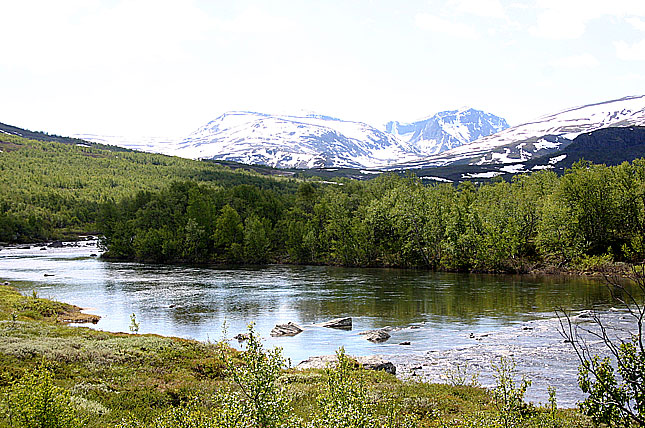
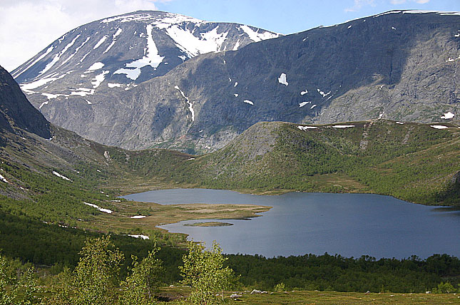
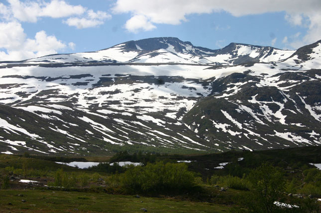
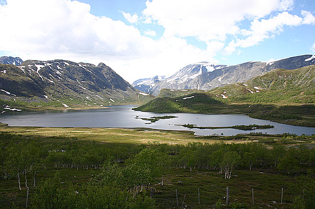
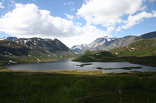
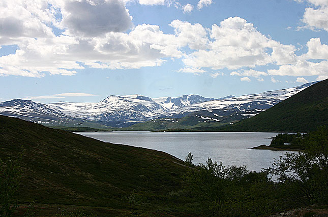
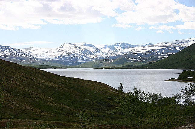
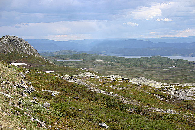
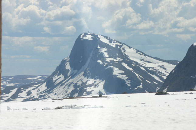
Here among the peaks of Jotumheim (Home of the Giants) it is overwhelming to see the grandiour of the nature, Though it was close to mid summer weekend, the snow was thick, exeding easily over one meter and some of the lakes was still covered with ice, while some was thawed up by the sun offering fishermen a break.
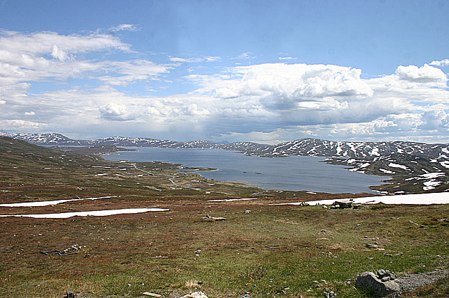
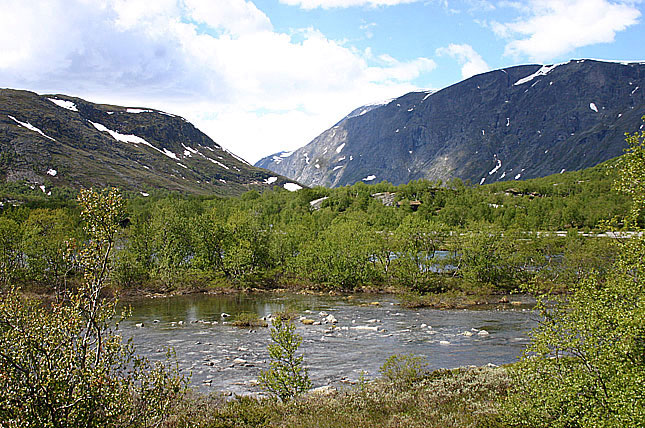
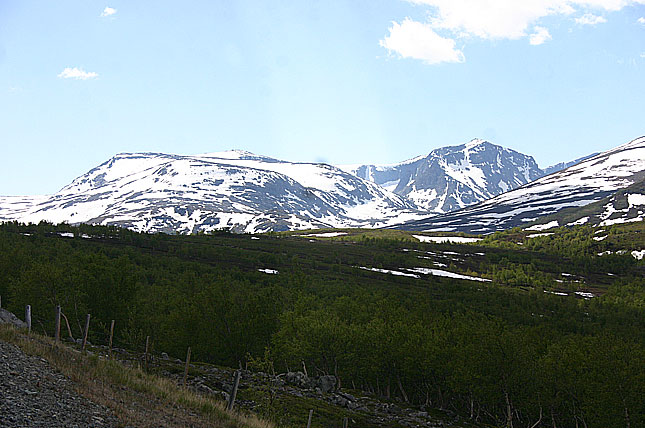
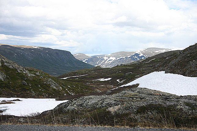
At this altitude it was a a funny effect to see high mountain peaks below the public road. But the scenery here is barren as we are well abouve the tree level, but still it offered a very pleasent mix of colors and shapes. The cold wind reminds you that this not a forgiving country if you get lost and in summer the temperature at night is close to the zero degrees Celsius and there is an ever blowing cold wind. Still there are a lot of tourists on the road, this day the majority were from the Netherlands.
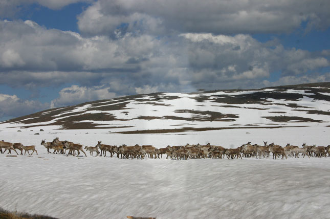
Reindeer crossing.

The reindeer is distributed throughout a number of northern locales. Reindeer are found throughout Norway and Iceland and the northern parts of Sweden and Finland; at Spitsbergen; in European parts of Russia including Northern Russia and Novaya Zemlya; in the Asian parts of Russia, to the Pacific Ocean; in North America (where it is called the caribou) on Greenland, Canada and Alaska, as well as parts of South Dakota, where they are known to migrate in the winter time. In 1952 reindeer were re-introduced to Scotland, as the natural stock had become extinct in the 10th century.
Southern-most reindeer: a South Georgian reindeer with velvet-covered antlers.Domesticated reindeer are mostly found in northern Scandinavia and Russia, and wild reindeer are mostly found in North America, Greenland and Iceland (where they were introduced by humans in the 18th century). The last wild reindeer in Europe are found in portions of southern Norway. The southern boundary of the species' natural range is approximately at 62° north latitude.
A few reindeer from Norway were introduced to the South Atlantic island of South Georgia in the beginning of the 20th century. Today there are two distinct herds still thriving there, permanently separated by glaciers. Their total numbers are no more than a few thousand. (The flag and the coat of arms of the territory contain an image of a reindeer.)

The wild, most caribou migrate in large herds between their birthing habitat and their winter habitat. Their wide hooves help the animals move through snow and tundra; they also help propel the animal when it swims. About 1 million live in Alaska, and a comparable number live in northern Canada.
There are an estimated 5 million reindeer in Eurasia, mainly semi-domesticated. The last remaining European herds of the genetic wild reindeer (of the subspecies tarandus) are found in central Norway, mainly in the mountainous areas of Rondane, Dovrefjell-Sunndalsfjella (see Dovrefjell-Sunndalsfjella National Park), Hardangervidda and Setesdalsheiene. Genetic analysis has shown this, and that the reindeer in Rondane and Dovrefjell is of Beringia origin, other wild Norwegian reindeer are of European origin and have interbred with domesticated reindeer to a various extent, the reindeer in Hardangervidda and Setesdalsheiane only to a limited extent. Some areas, such as Filefjell, have populations of reindeer that have been herded in the past but are now left free. Scandinavian domesticated reindeer are supposed to be a mixture of the two subspecies tarandus and fennicus - mountain and Finnish woodland reindeer. Males usually split apart from the group and become solitary, while the remaining herd consists mostly of females, usually a matriarchy.
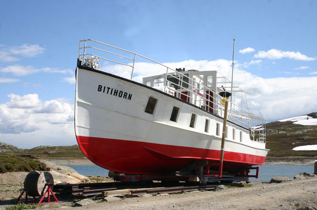
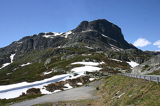
Bitihorn
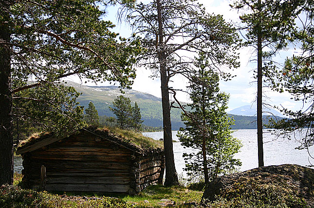
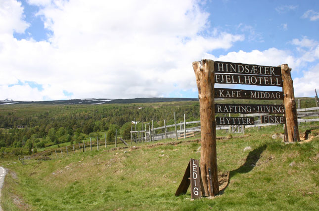
(elevation 1607 metres or 5 272 ft)Finding a well preserved steamer on a slip got me a bit curious so I looked up some info on the web.
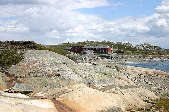
Bitihorn has become somewhat a symbolic sentry tower for the municipality of Ĝystre Slidre. It can be seen from most of the valley and the mountain plains on both sides. At the tourist resort, Beitostĝlen, which is only some km distant, it is used as the symbol of the tourist industry. The peak is climbed by an enormous number of tourists and locals during the summer season, mostly. It is easy to ascend from the north, even in the winter it is accessible.
It can also be climbed from the south, but good route knowledge is required in order to avoid technical climbing. From the northeast the route is well marked.
On the summit there is a huge antenna and a small cabin, which is closed to the public. The view from the summit is wonderful. To the south and east very little blocks the view to the rest of Valdres. To the north the Rasletind, Kalvehĝgde, Torfinnstindene and Galdebergstind mountains dominates the view, and to the west you can see the forbidding spire of Falketind.
In 1811 the peak was climbed for the first time in recorded history by the famous biologist Christen Smith. Except for the expedition by Jens Esmark in 1798 this biological expedition was the first mountaineering effort in Norway. Smith also climbed the much higher Besshĝ, further north.
Tourism soared in the late 19th century after the erection of Raudfjordheim lodge and later the hotels Bygdin and Bygdisheim in the vicinity. The extraordinary scenery attracted tourists from far away, among them queen Wilhelmine of the Netherlands, who stayed at Bygdisheim. In 1905 the boat route on lake Bygdin (1060 m above sea level - different elevations can be found since the lake is dammed), was opened. The boat, which is aptly named Bitihorn, still traffics the route from Bygdin Hotel to Eidsbugarden hotel in the western end for about ten weeks each summer. This was in the beginning of the 20th century a remarkable feat since there were no roads leading to the lake, but the boat was dragged there.
During WW II the steep east side was used by the German alpine troops for training. It is still possible to see at least one of the campsites used by them on the west side of the road. Earlier, until the 70s, paths of their mules could still be seen in the huge talus slope on the east side. The path is still there, but it is now made by sheep. Ruins of the mule stables, dug out in the soft soil on the east side of the road, are still visible. On the southern shoulder it is possible to find small one-man-shelters with holes for the guns. Some of these are probably built later as replicas, but some of them derives from 1941-1942.


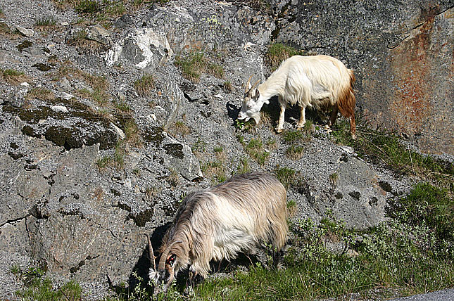
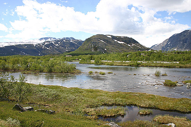
After leaving the large ski resort of Beltostölen, we headed to E16 northbound. We came across this waterfall at the foot of a mountain pass. And naturally as common in Norway, we met a few goats right at the highway. More photos will follow, but now it is time to see the Sognefjorden and the town of Songdal.
(Fagernes)
(part two) (part three) (part four)